Bhuvanagiri Fm
Type Locality and Naming
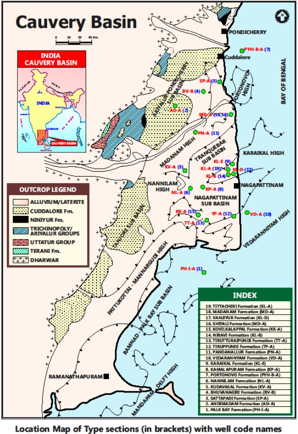
SUBSURFACE: The type section is located at exploratory well Bhuvanagiri-B, in the Ariyalur-Pondicherry subbasin (depth interval: 3365-3805 m). Hypostratotype lies in the well PY-C-B (depth interval: 3645-3875 m). It was named after the Bhuvanagiri village by ONGC team steered by Venkatarengan et al. (1993) and was issued as Document-VII by KDMIPE, ONGC, Dehradun (1993).
[Figure 1: Type-section Map of Subsurface Formations]
Lithology and Thickness
Sandstone. Predominantly sandstone with minor claystone and shale. Sandstone is pale grey to greenish grey, moderately hard, coarse grained, occasionally pebbly and conglomeratic, granular quartz, with minor feldspar and garnet as the typical minerals, feebly calcareous. Claystone is dark, hard, compact, silty, calcareous, fissile, micaceous, with very fine, well-developed laminations, alternating with fine sand and silt laminae, tending to be shale. Minor marlstone is recorded with the claystone. Maximum thickness 800 m+ in Bhuvanagiri area.
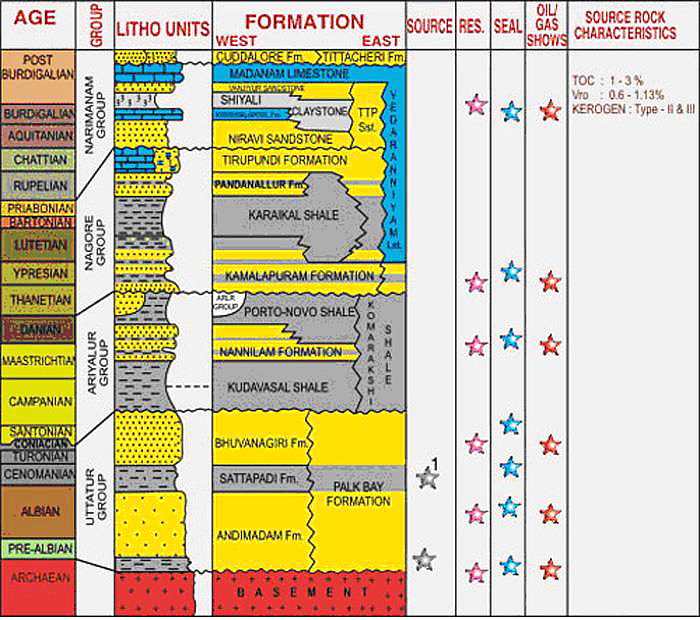
[Figure 2: Generalized Stratigraphy and Petroleum System of Cauvery Basin (from dghindia.gov.in)]
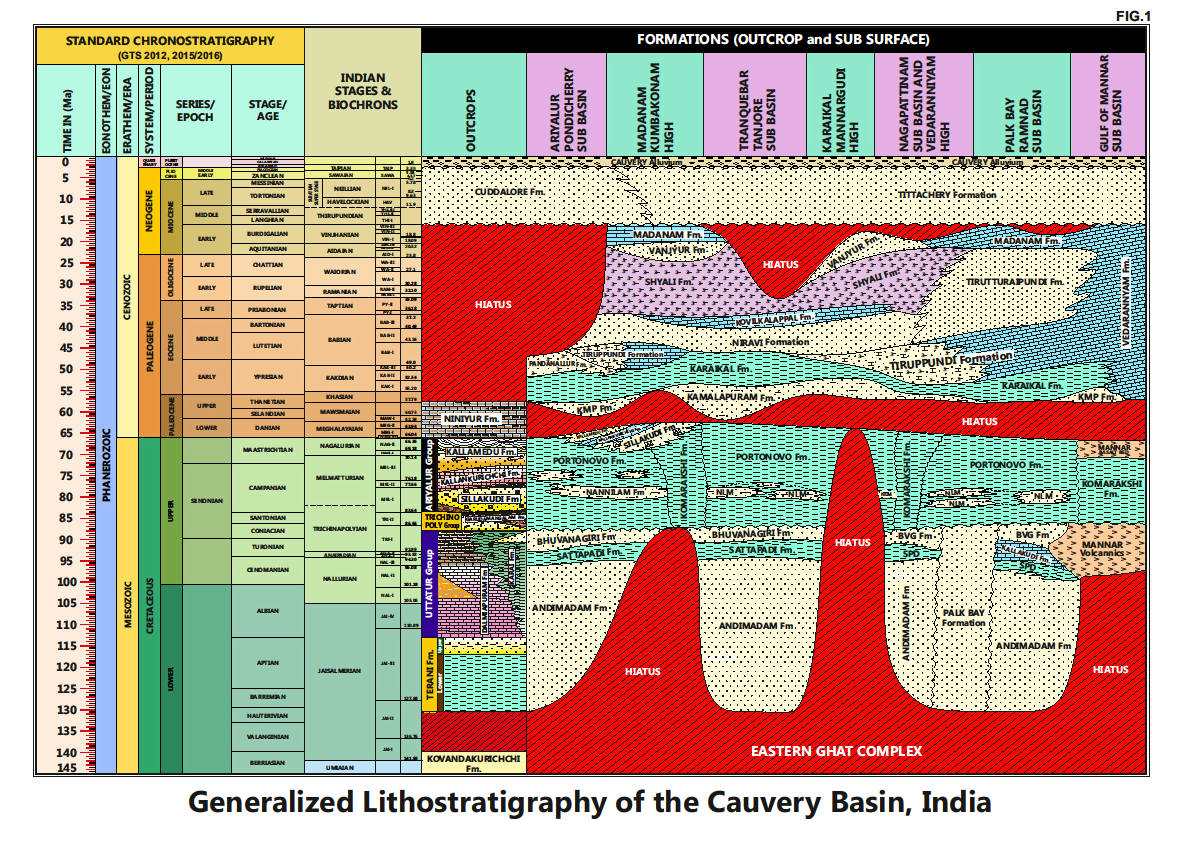
[Figure 3: Generalized Stratigraphy of Cauvery Basin (Provided by A. Nallapa Reddy & R. Nagendra)]
Relationships and Distribution
Lower contact
Conformable with Sattappadi Fm.
Upper contact
Unconformable with Kudavasal Fm / Komarkshi Fm.
Regional extent
Entire basin: Present in the entire basin, except in the Gulf of Mannar subbasin where there is the Mannar Volcanic Fm. It partly correlates with Dalmiapuram Fm / Karai Fm in the outcrops.
GeoJSON
Fossils
Age
Depositional setting
Outer neritic-Upper bathyal.
Additional Information
This formation promises potential for hydrocarbon occurrence.


